The Hill Road project
Council has received $50 million from the NSW Government to support investigations into flood reduction on Hill Road and in the surrounding area.
Funded under the NSW Government’s Western Sydney Resilience program, the project will begin with extensive studies including flood and traffic studies.
It is expected that the flood reduction infrastructure study will progress in tandem with the Draft Haslams Creek Flood Study project (see below) allowing the movement of water across the Wentworth Point peninsular to be modelled and various flood mitigation measures to be considered.
Reflecting the scope of the project, the funding will be provided over three years, allowing for initial studies, development of flood reduction measures and potential construction.
Council has also received $8.5 million in funding from the Australian Government to assist in scoping and implementing improvements for Hill Road including public domain improvements incorporating sustainable design measures as well as addressing safety concerns at intersections and improving street lighting.
For more information on the Hill Road project, please see our Hill Road Upgrade page.
Haslams Creek Flood Study
To enable the Hill Road Upgrade project, City of Parramatta Council is about to begin a flood study for the Haslams Creek catchment area. The study will take in the areas of the Carter Street Precinct, Lidcombe, Newington, Sydney Olympic Park, and Wentworth Point.
As part of the flood study (Stage 1), Council asked local residents to share their flood experiences and contribute photographs or video of any local flooding events.
This data collection is the first step to creating a flood model (Stage 2) and a Floodplain Risk Management Study and Plan (Stage 3). Submissions closed 11 December 2024.
What is a flood study?
A flood study is a technical investigation of flood behaviour and allows Council to identify the risks from different sized floods, from small floods up to the largest possible flood.
The study models the likely path of floodwaters and the likely depth, and provides Council with an understanding of flood risk so it can manage existing development, plan for future development and help the SES plan how to react to flood emergencies.
The Draft Haslams Creek Flood Study is expected to be placed on public exhibition in 2025.
Map
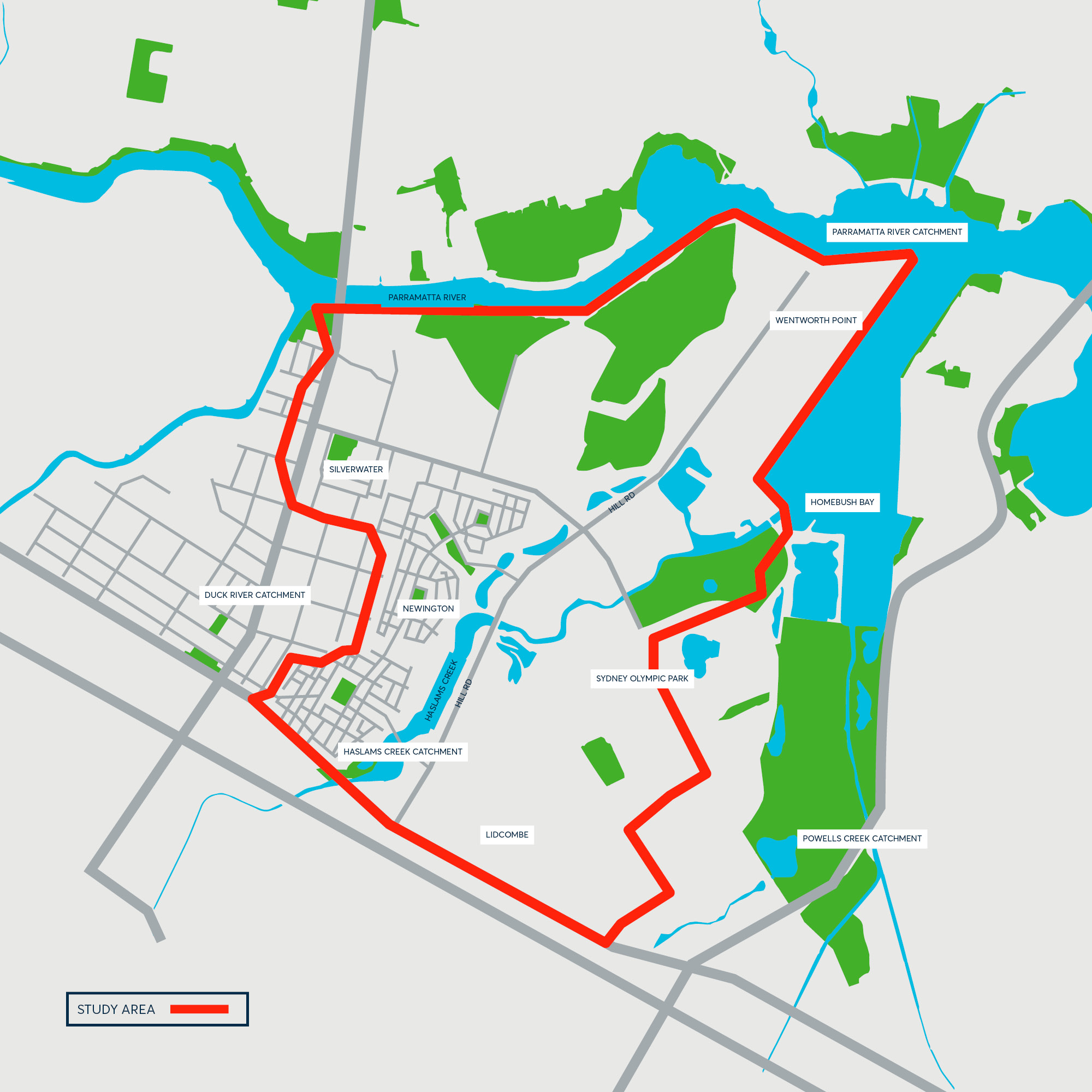
Carter Street Precinct, Hill Road Precinct, Lidcombe, Sydney Olympic Park and Wentworth Point to get FloodSmart
In addition to advocating for improvements to drainage and flood management on the peninsular, City of Parramatta has been working on capturing data and setting up additional monitoring in order to expand its award-winning FloodSmart Service.
From early-2025, the FloodSmart service will expand to cover 14 monitoring sites across the Local Government Area providing early warning information about flood conditions in real time to subscribers.
Residents and business owners in the Carter Street Precinct, Hill Road Precinct, Lidcombe, Sydney Olympic Park and Wentworth Point can receive free flood warnings and updates via SMS, email or voice message.
Council will provide more information on how to subscribe once the monitoring system for Haslams Creek has been tested and is live.
Visit Floodsmart for more information on the FloodSmart Service (currently monitoring 10 sites)
For more information on this project
Call: 1300 617 058
Email: hillrd@cityofparramatta.nsw.gov.au

The $58.5million Hill Road flood resilience project and safety improvement project is proudly funded by the Australian and NSW Governments in association with City of Parramatta Council.